Marava Country is the only country in India having the name of caste. And it is the only tamil speaking country ruled by only tamils described in Portugese,dutch,French and British.
This is the only Country with the Caste name.
In India in colonial period and southern part before british is separated as Carnatic,Golgonda,Malabar,Tanjore,Mysore,Madura and Marava.
In the southern part Carnatic and Golgonda and mysore belong to Muslims takeover.
Only Hindu Provinces are Malabar,Madura and Marava.
Out of three Malabar ruled Malayalam speaker,Madura ruled by
telugu speaker. Tanjore ruled by Marathi speaker.
And Only Tamil speaking is Marava province King Sethupathi.
Before Europeans there is no Maps in India and the no Historical accounts marked by any historians.
Marava Country is the Only Tamil Province and Only Tamil country in the Maps.
Portugese East India Company Map:
The portugese East India company dated in 1670s noted the Country of Marava and Madura in their Maps.
Dutch East India Company Map:
The Dutch East India company dated in 1700s noted the Country of Marava as 'DE MARAVA' in their Maps. It is noted by dutch east India Company.
French East India Company:
This French Map of South India dated June 1737 was created by Jean Baptiste Bourguignon d'Anville, one of the greatest geographers and cartographers of the 18th century. The Marava country, colored in yellow, is located immediately south of Tanjore. Rather than a single political entity, it was a collection of small states ruled by the Maravars, a dominant Tamil community in the south of modern Tamil Nadu. Some of the prominent Marava centers of power include Sivaganga and Ramanathapuram.
British East India Company:
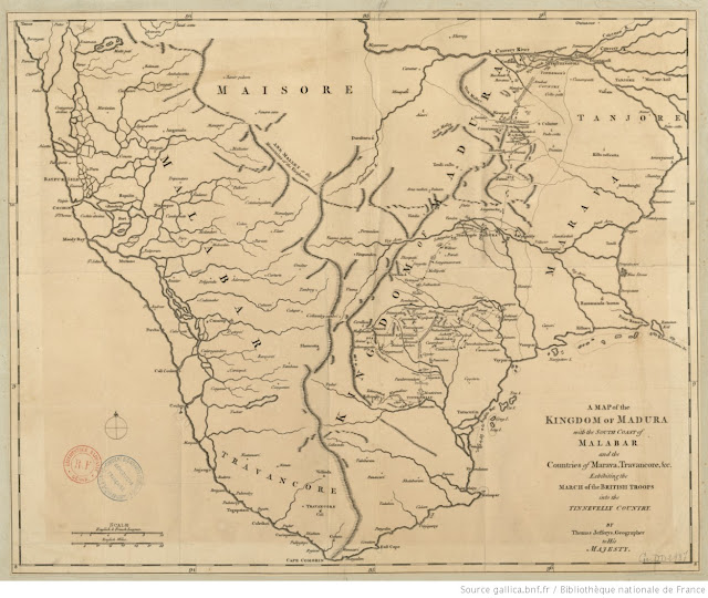
This British Map of South India dated June 1764 was created by British Troops in the invasion of tinnevelly. It is Marked by British troops. It is Noted by Jeffry Thomas. Rather than a single political entity, it was a collection of small states ruled by the Maravars, a dominant Tamil community in the south of modern Tamil Nadu. Some of the prominent Marava centers of power include Sivaganga and Ramanathapuram.
Source:
Mission of Madura(Accounts of De joe Britto)
Dutch Map of Malabar and Coromandal
French source civfanatic
A_map_of_the_kingdom_[...]Jefferys_Thomas


No comments:
Post a Comment
Note: Only a member of this blog may post a comment.